


Corinth Canal, Greece – 2/2014
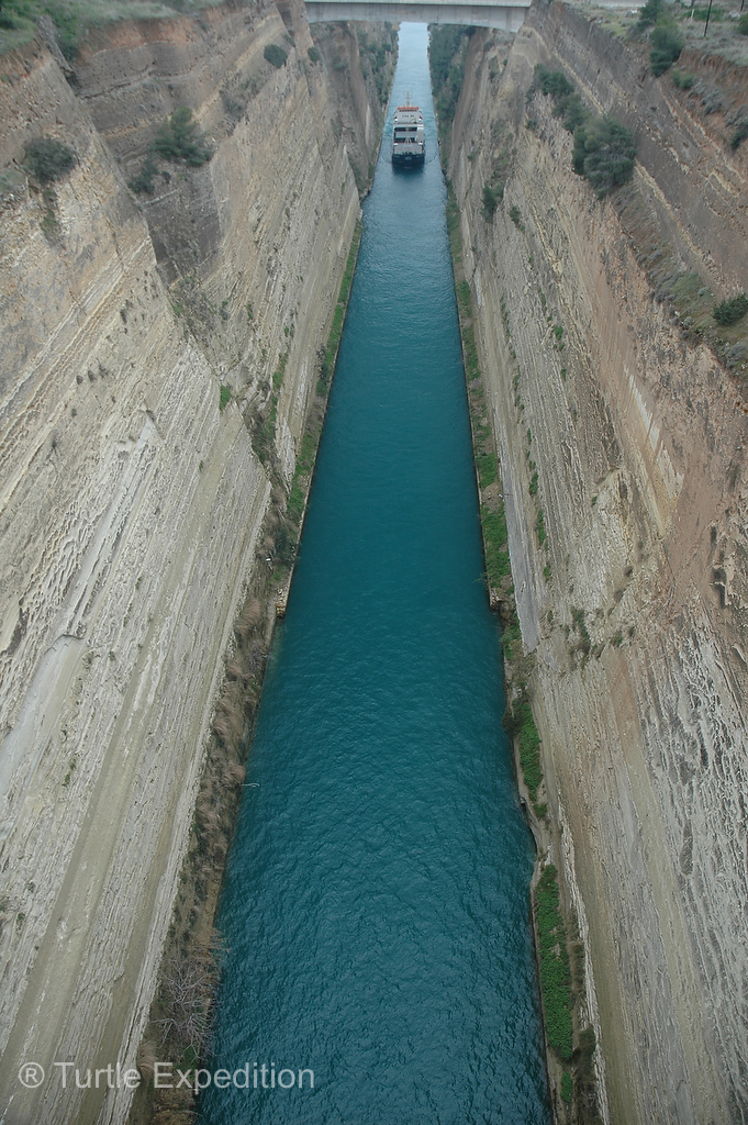
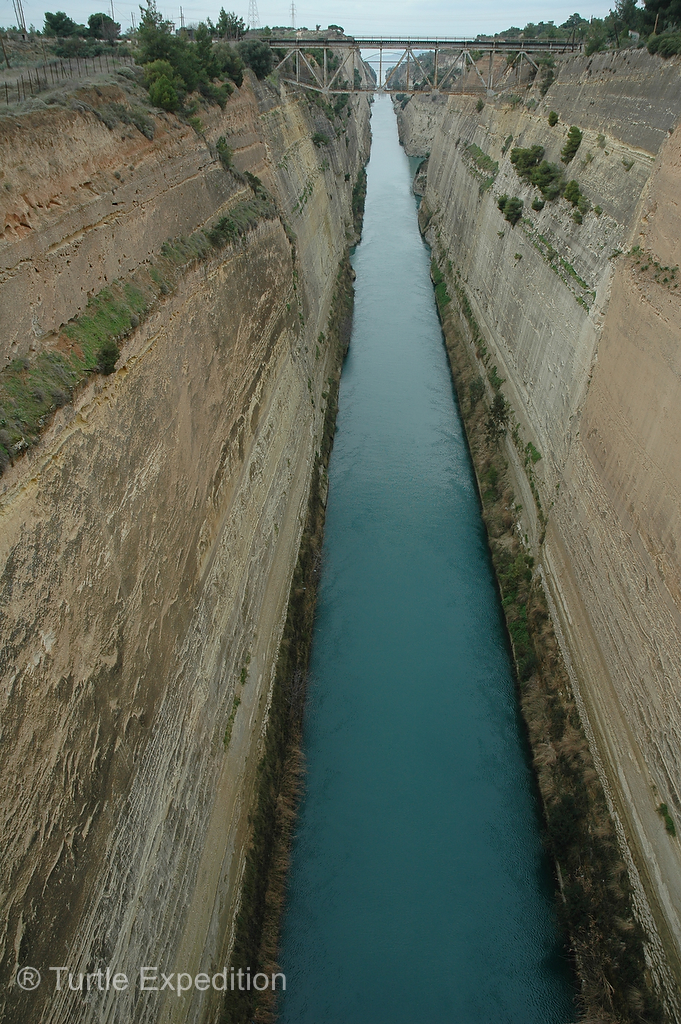
Leaving the Peloponnese and heading to Piraeus, the Athens harbor, we had to cross the famous Corinth Canal that connects the Gulf of Corinth with the Aegean Sea. Cut through the narrow Isthmus of Corinth, it effectively makes the peninsula of the Peloponnese an island.
 Several rulers in antiquity dreamed of digging a water passage through the Isthmus. The tyrant Periander was the first to propose such an undertaking in the 7th century BC. (Can you imagine having to cut this canal with hand tools?) Abandoning the project, he constructed a simpler and less costly overland portage road, named the Diolkos, (stone carriageway), along which ships could be towed from one side of the Isthmus to the other. Remnants apparently still exist near the modern canal.
The idea of the Corinth Canal was revived after Greece gained formal independence from the Ottoman Empire in 1830, and especially after the openings of the Suez and Panama Canals, though it was not until 1882 in the presence of King George I of Greece that construction started. Despite several bankruptcies of companies and unstable walls in this seismic area, it was finally completed in 1893, eleven years later. There were still many more problems to contend with including eroding walls and World War II damage. (Read up on Wikipedia, it’s quite interesting.)
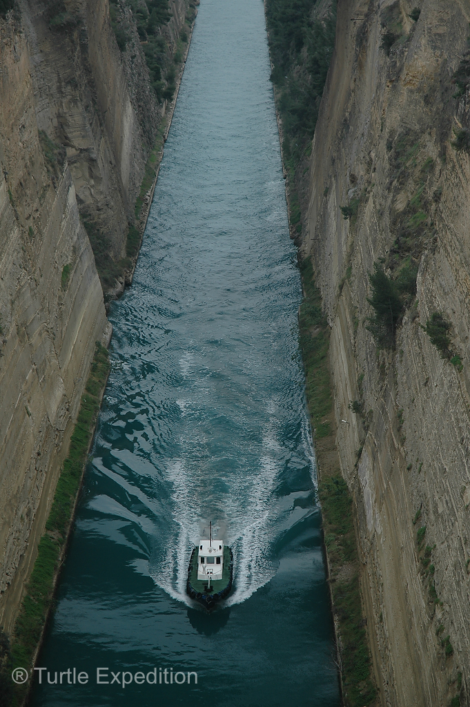
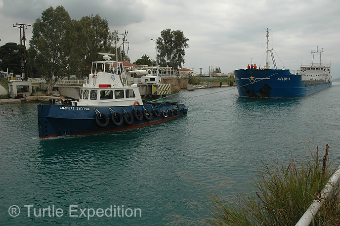
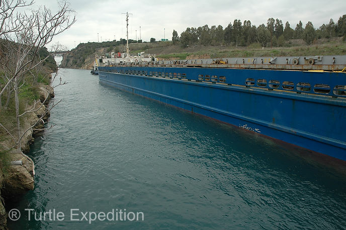
Though the waterway saves a 700 kilometer, (430 miles), journey around the Peloponnese, it is too narrow for modern ocean freighters. Ships can only pass through one at a time on a one-way system. Larger ships have to be towed by tugs. Today it may be used more by sightseeing tours, but 11,000 ships travel through the waterway every year.
Statistics:
Excavated at sea level thus not requiring any locks.
Length: 6,346 meters/20,820 feet
Depth: 8 meters/26 feet
Width on top: 24.6 meters/81 feet
Width on bottom: 21.3 meters/70 feet
Height of walls: 90 meters/300 feet.
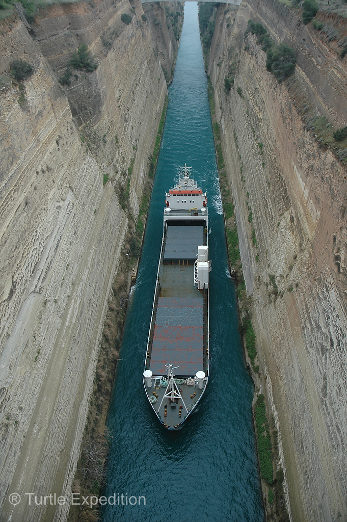
The rock walls rise at a near-vertical 80-degree angle.
Bridges: railway line, a road and a freeway bridge at the height of about 45 meters/148 feet and a surprise, see below.
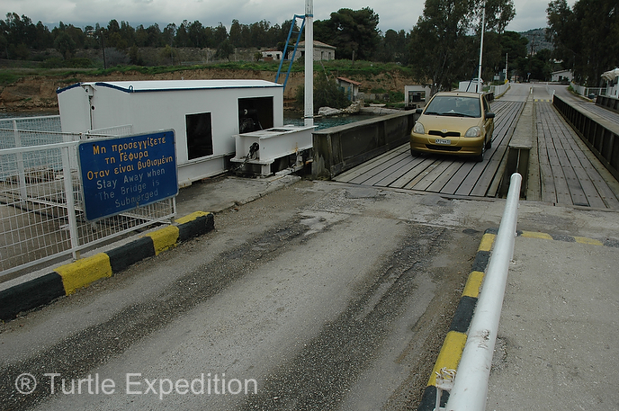
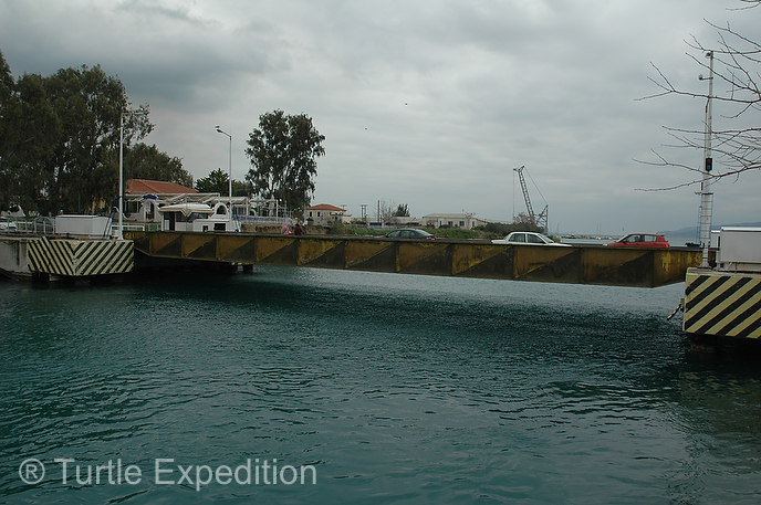
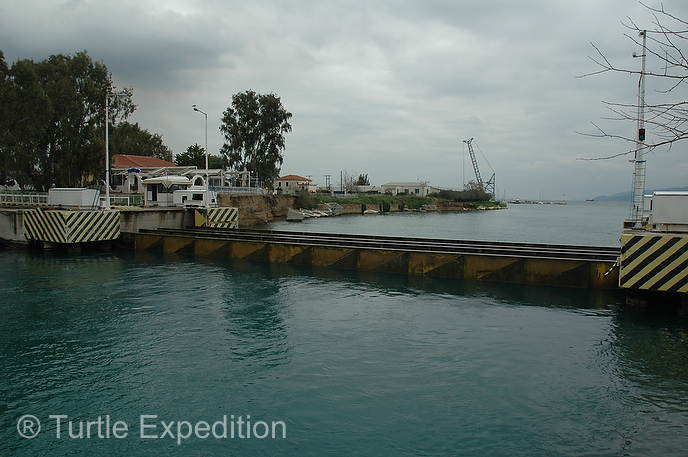
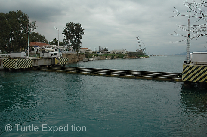
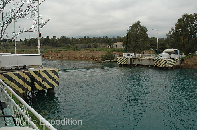
We followed Monika’s sister’s tip and headed for one of the submersible bridges that apparently were installed at sea level at each end of the canal in 1988. How clever! Soon after we arrived, the lights started blinking and to our amazement, the bridge really began to sink and then disappeared. Three big commercial ships passed us at safe distances from each other. Crewmen were on deck. We all waved and took photos of each other. At other times of the year, the two outdoor restaurants would be full with curious onlookers, all sipping cold Frappé, a popular frothy coffee drink.
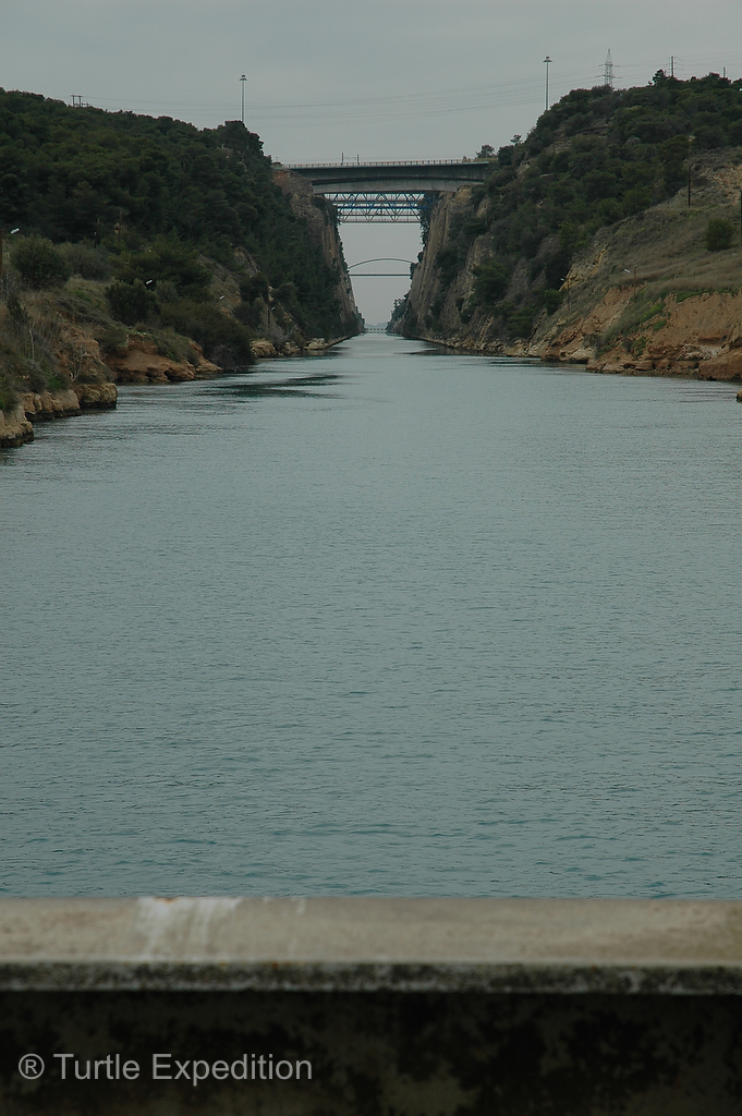
Later, we did walk over the high road bridge, snapping photographs of more ships heading our way from the Aegean Sea. One seemed so wide, it almost touched the vertical walls.
Passing over the historic Corinth canal we drove to the Piraeus harbor from where we would ship over to the island of Crete.
-
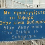
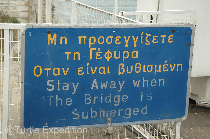
- One of those more that self-evident signs, like “Caution: Slippery when wet or frosty”.
-
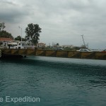
- It was quite interesting to watch the bridge actually sink to the bottom of the canal, and then rise again for normal traffic.
-
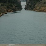
- The entrance to the canal is less impressive than when seen from above.
-
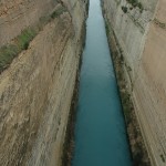
- The rock walls rise at a near-vertical 80-degree angle. The unstable walls in this seismic area were a problem during its construction.
-
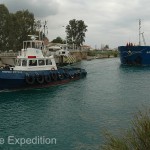
- We watched a couple of big commercial ships pass us at safe distances from each other. Obviously, traffic is one way.


Leave a Comment