


Hiking the John Muir Trail
THE JOHN MUIR TRAIL
A Long-Held Dream Fulfilled
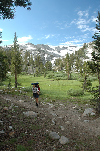
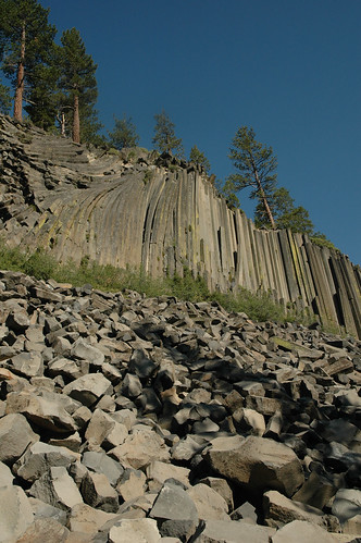
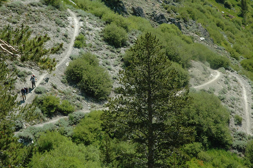
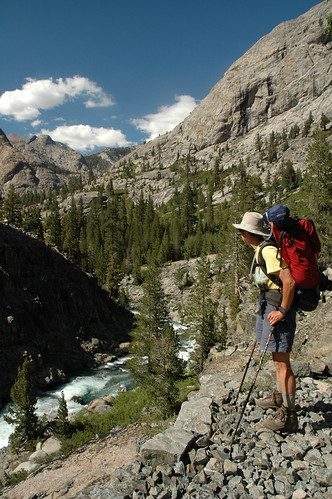
It is the kind of day you could expect in the Yosemite Valley in late July. The crisp air of an electric-blue sky embraces the smoky perfume of early morning campfires. We slurp down hot coffee and a bowl of granola, shoulder our Kelty Tioga packs, adjust our MSR trekking poles, and head up the trail to Happy Isles, the official start of the John Muir Trail.
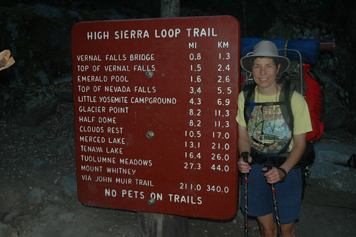
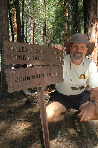
The trail sign at Happy Isles is the traditional starting point for the John Muir Trail.
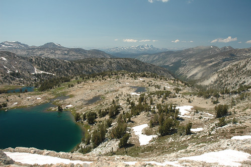
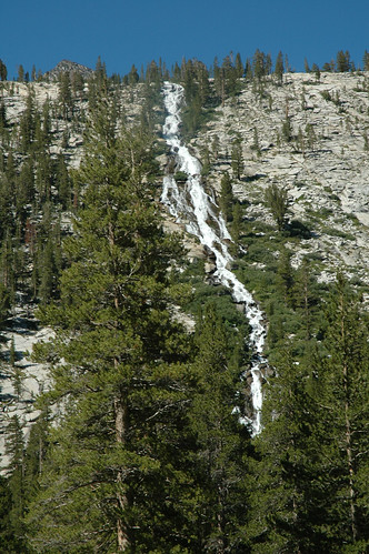
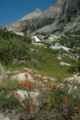
Yosemite Valley is an awesome place to start any backcountry hike.
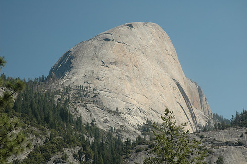
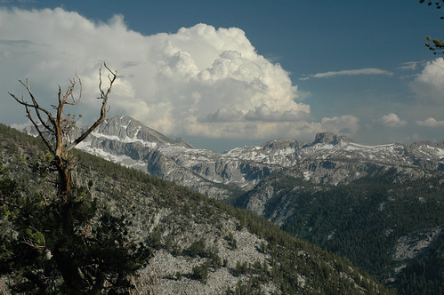
The glaciated domes of Yosemite Valley are amazing.
You’ve heard of it right; the JMT? It’s a National Treasure. Passing through arguably the most spectacular mountain scenery in the U.S., through a land of 13,000 and 14,000-foot peaks, rushing rivers, thousands of trout-filled lakes, deep canyons, and astounding glacier-carved granite cliffs, it’s also blessed by the mildest, sunniest climate of any major mountain range in the world. By virtue that you are looking at this Web Site, we might assume that you are a camper, backpacker, or at least a person with the spirit of adventure. If you are thinking of hiking the amazing John Muir Trail, or any part of it, you will surely be able to learn what to do, bring, prepare, and contact by reading this report. If you are determined to go as light as you can—we were not—you can find that type of quality camping and backpacking equipment from the same sources we used.
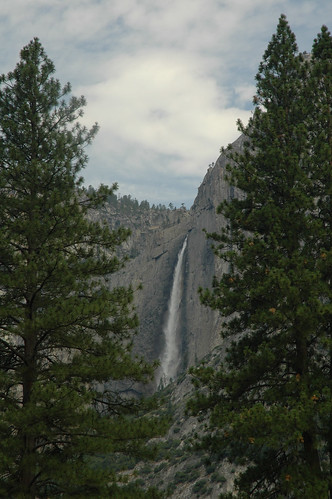
DAY 1: July 19, 2006 The view across to Nevada Falls already gave us the rush of being in the high country.
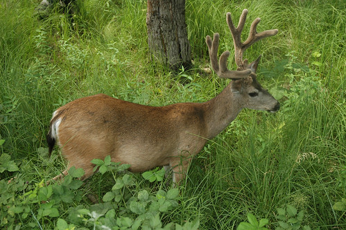
Despite the crowds in Yosemite, this young buck ignored our passing.
The John Muir Trail had always been one of those quite obtainable goals, unlike climbing Mt. Everest, rafting the Yangtze River in China, or skiing to the North Pole. It had been right there in front of our faces for 40 years. It was time.
Starting in Yosemite Valley, the JMT runs 216 miles, plus some side trips to resupply, all the way to the top of Mt. Whitney, the highest point in the lower 48 States, passing through 3 National Parks and 2 Wilderness Areas along its tortuous route. The total elevation gain is 43,600 feet!! —not all in one day mind you. The trail crosses only two roads, one in Tuolumne Meadows, and a second in Reds Meadow. From there, it doesn’t hit any civilization again until Whitney Portal, just out of Lone Pine on Hwy 395.
Day 1, July 19, 2006
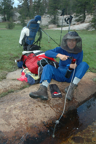
Long Meadow. Filtering water was a daily chore. Our MSR WaterWorks EX pump screwed directly onto one liter Nalgene bottles and our MSR Hydromedary 2 liter hydration bags.
The beginning of a long-time dream, the John Muir Trail has waited for us.
The switchbacks up to Vernal Falls are miserably endless. We stop frequently for water and sweat wipes. Arriving in the Little Yosemite camp area, we head for the river, take off our clothes, and jump in. It’s painfully cold. Tired as we are, our collapsible bucket saves many trips to nearby water—or sometimes not so nearby— along the trail.
Day 2, July 20
No bears to be seen, but a chipmunk bites a hole in one of the tubes on our hydration bags. Electrical tape in the repair kit fixes it. We hike in freezing rain over Sunrise Ridge and camp above Long Meadow, totally exhausted. While the weather is normally quite mild in the Sierras, you must go prepared for anything. We saw people hiking through snow in sandals. Necessary for fording streams, but not too good for hiking rocky trails with a pack in our opinion. The rumors of mosquitoes being bad are true.
Day 3, July 21
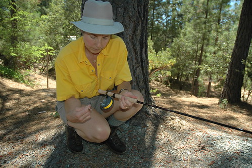
Fenwick makes one of the few high quality four-piece take-apart combination spin and fly casting rods for backpacking. www.fenwickfishing.com
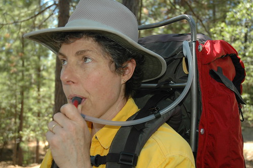
Staying hydrated on the trail is extremely important. Our 2-liter MSR Hydromedary water bags were convenient while we hiked, and our MSR water filter screwed directly onto their fill opening. www.msrgear.com
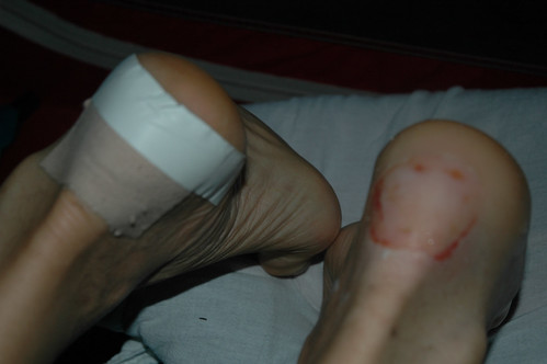
Climbing over 9,900 ft. Cathedral Pass, the anticipated blisters are starting to appear. The Post Office in Tuolumne Meadows has our first food drop, and after a chocolate milkshake, we make camp and check our packs to see what non-essential stuff we can send home. Yes, we were already wishing we had lighter packs, but it’s such a compromise. Over the entire JMT trek, we mailed back exactly 18 pounds. Some things were truly not needed. Others, like our light-weight Fenwick combination fly and spinning rods and ultra-light Shimano reels, would be missed many times.
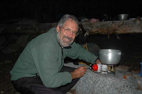
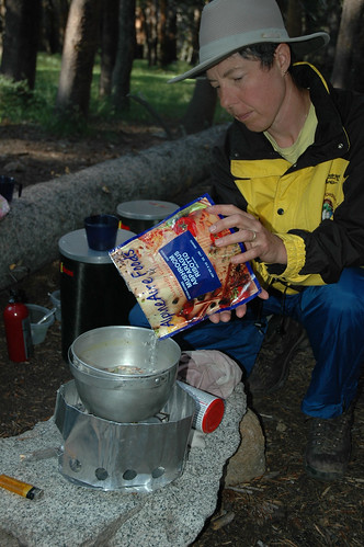
Cooking healthy food on the trail is important. Our Coleman Exponent Apollo light weight backpacking stove was fast and reliable. www.coleman.com
This hike was not a last minute decision. We needed a Wilderness Permit, available from the Wilderness Management Office, (209-372-0285). July to September is generally the best window, but that varies, depending on the snow pack. A very limited number of permits are issued each day to prevent over crowding. Many people hike only a section of the trail. We wanted to do the whole JMT, start to finish, in 28 days. That was a nice pace, with time to enjoy the adventure.
In retrospect, knowing how good the fishing was in the many streams and lakes, we could have taken at least an extra day or two between food drops. Our Bearikade Expedition, www.wild-ideas.net, containers were the best, but they could hold no more than about seven to ten days worth of supplies.
Day 4, July 22
The hike up Lyell Canyon along the Tuolumne River is absolutely breathtaking. Already we wished we had not mailed back all our fishing gear. Wildflowers everywhere. Butt-kicking switchbacks bring us to Lyell Fork at 9,650 feet. Blisters are a problem, but we are getting used to the altitude. It rains again. Glad we have a good tent.
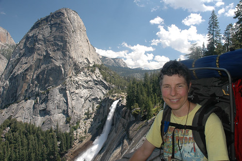
Monika pauses above the Lyle Fork of the Tuolome River.
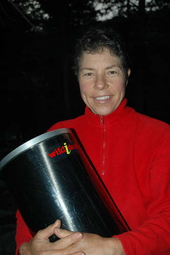
Our light-weight Bearikade Expedition MKII food canisters by Wild Ideas met all Park Regulations and could contain seven to ten days of food. www.wild-ideas.net
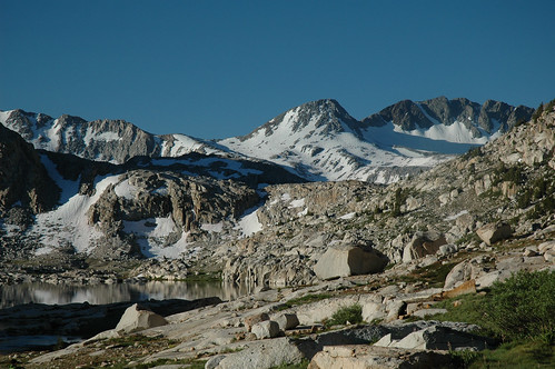
Hiking towards Donohue Pass, we enjoyed early morning sunshine. It didn’t last.
Day 5, July 23
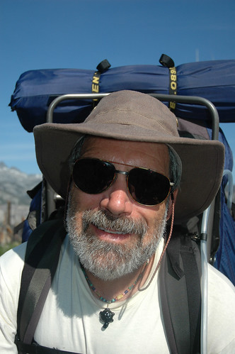
We reach Donohue Pass, 11,056 feet, in driving hail and rain, and dig out the ponchos and our Kelty pack covers. Only a quarter mile of snow to cross. Not too bad. What’s with this weather? A party of packhorses has made a mess of the muddy trail. Hail turns to a steady rain with a cold wind. We slop downward in ankle-deep muddy water. Sometimes it’s better to walk on the side of the trail. I am glad for the wide brim on my Tilley hemp hat www.tilley.com, which keeps my glasses dry.
Small mountain lakes became increasingly beautiful as we climbed into the Sierras below Donohue Pass.
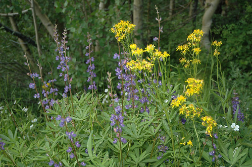
Spring wild flowers were amazing even at higher altitudes.
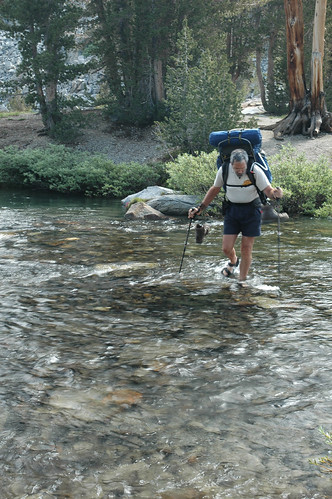
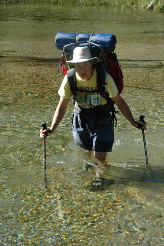
Creek and river crossing were numerous. Our Teva sandles kept our boots dry. www.teva.com
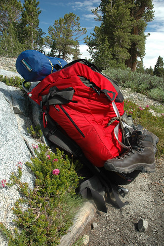
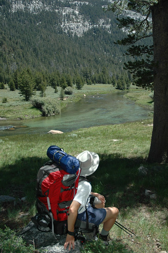
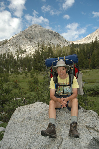
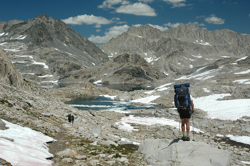
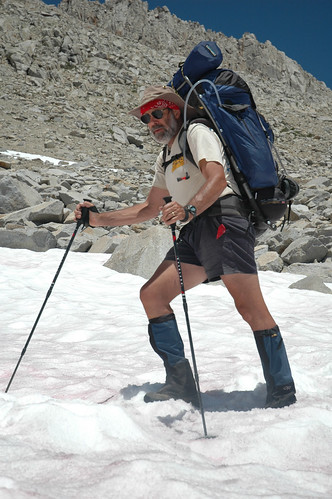
Our Kelty Tioga 5000 and Tioga 5500 external frame packs were ideal for carrying the heavy loads on this extended trek. www.kelty.com
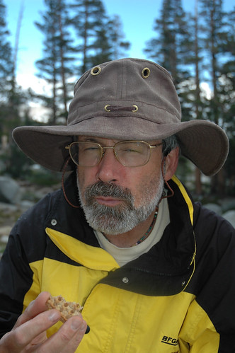
Gary’s natural hemp Tilley hat kept rain, sun and hail off his head and his glasses. www.tilley.com
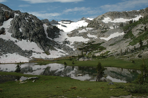
We rested at this snow fed tarn before tackling the last climb over Donohue Pass, 11,056 ft.
Rush Creek Camp. Our MSR 3-men Mutha Hubba tent proved to be an excellent choice for all weather conditions. www.msrgear.com
After two difficult stream crossings which require us to take off our boots and unpack our Teva sandals, www.teva.com, the sky finally clears, and we find a perfect camp near a babbling creek. While our boots dry in the warm sun, we relax on our Therm-A-Rest Trekker Lounge chairs, www.cascadedesigns.com, and the world is good again.
Day 6, July 24
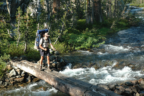
Some of the more difficult creek crossings had log bridges. This was a wide easy one also used by packers.
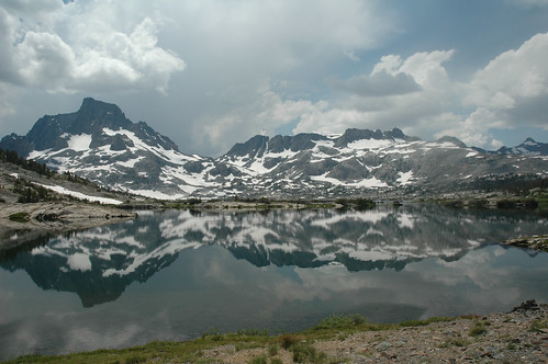
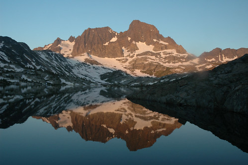
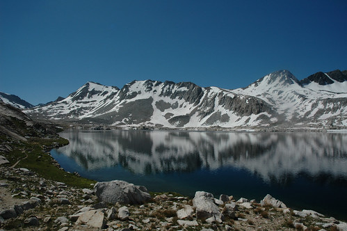
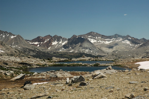
Mountain Peaks reflecting off glassy surfaced lakes captived us.
Gorgeous day. Not a cloud in sight. We ford Rush Creek several times. Mosquitoes are bad. We’re glad for our Outdoor Research mosquito head nets, www.orgear.com. After a particularly difficult stream crossing and 45 minutes on the trail, I check our Lowrance iWay Expedition c GPS, which has detailed topo maps of the entire trail loaded on a memory card, and we are on the wrong side of Waugh Lake. We backtrack. A dumb mistake that means re-crossing the dangerous river again on a slippery log that is several inched under the swift water. Monika almost goes in. Thank goodness for trekking poles!!! At Garnet Lake we see why it was a favorite of Ansel Adams. We take the only decent but overused campsite worth getting to for a one-night stay. Blisters are worse. My boots are coming apart at the seams, so I fix them with Gorilla Glue. They are clearly not going to make the whole trail. The views of the mountains across the lake in the morning are amazing.
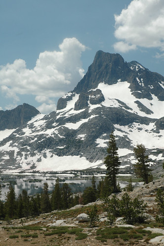
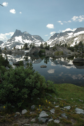
Banner Peak reflects itself in Thousand Isand Lake.
Food and equipment needed some research and calculations. Bear-resistant food canisters are required virtually everywhere, and even the Bearikade Expedition, www.wild-ideas.net, containers we chose could hold a maximum of seven to ten day’s worth. That meant we needed at least three, or preferably four resupply stops. These are available without hiking too far off the trail, or you can have a packer bring in your food and drop it off at a predetermined spot with a bear box on a predetermined date.
We had food and supplies waiting for us at the Tuolumne Meadows post office, Vermilion Ranch, and Muir Trail Ranch, all mailed weeks before our start. We also arranged for the Pine Creek Pack Station, (Sequoia King Pack Train), www.bishopvisitor.com/activities/exp_pack_trips.php3 to bring in our last food drop and leave it in the bear box at Charlotte Lake, saving us the two-day hike over Kearsarge Pass. This worked out exceeding well, because after Charlotte Lake, there are no easy places to hike out for supplies, and our third resupply at Muir Trail Ranch was still 120 miles from Whitney Portal. Since our bear canisters only held 7 days of food, that would mean we had to average about 17 miles a day, with several of the most difficult passes to climb. Enough said, if you are planning on a relatively leisure hike, you must resupply at Charlotte or hike out to the Onion Valley Pack Station, or reduce your food consumption when your energy level is critical.
Day 7, July 25
Around every bend, the vistas changed.
Devil’s Postpile and nearby Reds Meadow Resort gave us a rest stop and the opportunity to run into Mammoth Lake to buy new boots for Gary.
Garnet Lake 6:19 AM. Banner Peak and Mount Ritter reflect the morning light into Garnet Lake, an Ansel Adams favorite.
Mostly downhill after a couple of low passes. We’re starting to meet people hiking the JMT and the Pacific Crest Trail. They are a good source of real-time information about conditions ahead, especially bears, river crossings, and snow fields. We hike through an old-growth forest of magnificent huge trees. Reaching Devil’s Postpile and Reds Meadow, we take a long hot shower in the free hot spring facilities. The water is almost too hot, but a local gave us a tip; use the lowest room, even if you have to wait. It’s cooler.
Day 8, July 26
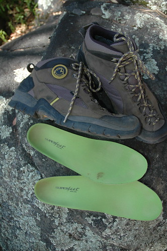
The combination of La Sportiva hiking boots and Superfeet insoles we found at Kittredge Sporting Goods in Mammoth Lakes eliminated the blister problems we were having and basically saved the trip. www.sportiva.com
Despite many miles of pre-trip break-in, Gary’s old fashioned stiff boots created massive blisters. The solution was a pair of La Sportiva Mid XCR that felt like bedroom slippers. www.sportiva.com
Realizing my boots are hopeless and my blisters are serious open wounds, we catch the bus into Mammoth Lakes. We meet Wes Morrison at Kittredge Sporting Goods, www.kittredgesports.com, an extremely knowledgeable boot expert. After careful assessment of my feet and what we are doing, he suggests a pair of La Sportiva, www.sportiva.com, Venture Mid XCT boots and set of Superfeet insoles. They feel like bedroom slippers. We are lucky to meet Wes. He knows how to match boots to an individual, and even the Superfeet insoles, www.superfeet.com, sold to me in Sacramento were the wrong size and needed trimming and smoothing of the toe. The Venture Mid XCTs have a design similar to a rock climbing shoe, with laces further down than a normal hiking boot. This allows for great lateral support without being too stiff, and just a bit heavier than what looks like a tennis shoe.
Our next stop is the local drugstore where we resupply our first aid kit with items Wes recommended and get back to the Mule Café at Reds Meadow in time for a juicy cheeseburger and pie a la mode. Life is good again.
Day 9, July 27
Gary’s new La Sportiva boots were like bedroom slippers, putting a smile on his face. www.sportiva.com
Thunderheads build over Cascade Valley as we descend to Purple Lake.
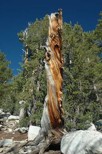
The twisted gnarled tree stumps amazed us with their weathered beauty.
New boots are really fantastic! We make almost 15 miles to camp at Purple Lake. Mosquitoes are life threatening, and more rain dampens our spirits.
Food was certainly a major concern. We burned a lot of calories. Backpacking stores, like REI and Adventure 16 sell a huge variety of lightweight freeze-dried meals. We found a healthy selection of bulk ingredients from AlpineAire, www.tyry.com, and prepackaged most of our meals using a FoodSaver vacuum machine, www.foodsaver.com. Many basic components like instant brown rice, bulgur wheat, and couscous were found in the local grocery store. The inexpensive light-weight packs of Top Ramen soup were a good way to start dinner. There were luxuries. I refused to drink instant coffee for 28 days. A little research turned up the AeroPress coffee maker, www.azuremoon.com, which was magic. We discovered the delicious LäraBar energy bars, www.larabar.com, on which you can understand every ingredient without a PhD in chemistry.
Not that you should count on it, but at all three resupply points we had, there were boxes or barrels of food left behind by fellow hikers who needed to lighten their packs. Really good stuff like glass jars of peanut butter, bottles of olive oil, and bags of candy. All very heavy!
Day 10, July 28
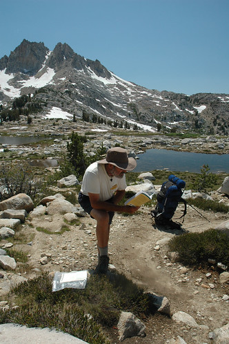
Squaw Lake, 10,300 ft. We pause to consult our guide to the John Muir Trail and the waterproof Tom Harrison map pack.
Switchbacks drop steeply into Tully Hole.
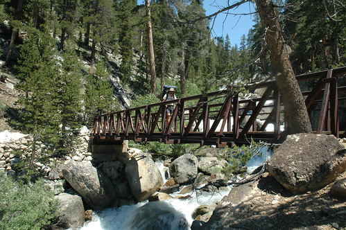
The steel bridge over Fish Creek was a welcome sight. Without it, the crossing would have been treacherous.
Monika’s blisters were still a problem but they were tolerable.
Steep switchbacks climb over a ridge to Virginia Lake. Wild flowers are unbelievable. Silver Pass, 10,990 feet, gives us majestic views into the valley. We find a nice camp near water and we wash a few clothes. Clean socks are especially important, and we only carry one extra set of undies and T-shirts. A long nylon clothesline is worth its weight.
Our camp near Silver Pass Lake was an idyllic High Sierra location.

Traversing around the inlet of Lake Virginia, we found beautiful campsites and a trout filled creek.
The view from Silver Pass, 10,900 ft., was dramatic.
Day 11, July 29
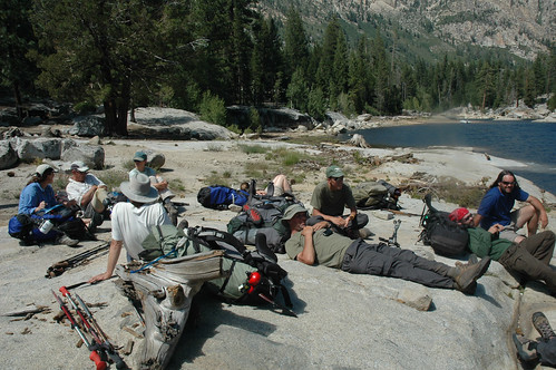
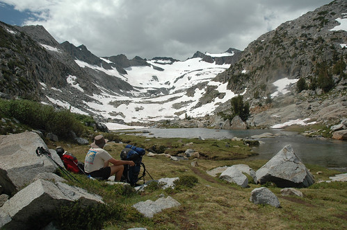
A group of JMT and PCT hikers relax on the rocks while we wait for the barge that will ferry us over to Vermillion Valley Resort and our second food drop. www.edisonlake.com
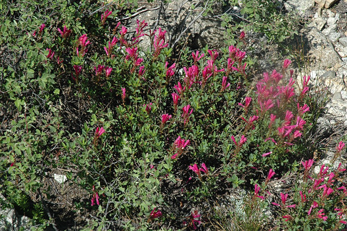
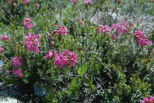
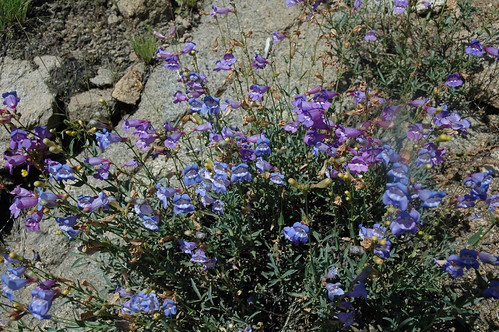
These pretty penstamon are native to the Sierras.
Left the rain fly off the tent last night, and we are surprised by a little thunderstorm around 1:00 AM. We make it to Edison Lake to catch the barge over to Vermilion Ranch where our second food drop is waiting for us. A bottle of wine with a good steak in the restaurant makes for a happy day. People we meet on the trail are starting to feel like a big family. One guy, Ed, is hiking with prosthesis from the knee down. Amazing! We joke about him not having any blisters on that foot.
Hiking beneath these towering granite cliffs, we realized that only people who venture into this High Sierra Wilderness get to experience this awesome beauty.
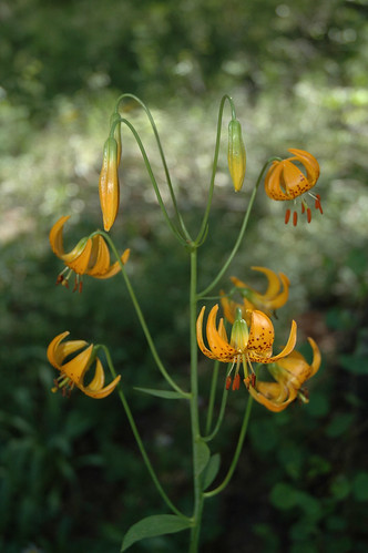
These beautiful tiger lilies were a rare treat along the trail to Lake Thomas A . Edison.
Spring run-off from a heavy winter snow pack cascades down cliffs to feed Silver Pass Creek, one of the most dangerous fords on the JMT. Our Guide to the John Muir Trail advises: “A slip here could be fatal”.
Day 12, July 30
We catch the 9:00 AM barge across the lake and head up over Bear Ridge to camp at Italy Creek. The scenery is beyond words.
Fires are not permitted in most areas, including anything above 9,600 feet. While there are many options, we found the Coleman Exponent Apollo camp stove, www.coleman.com, to be one of the lightest, most powerful, and most reliable. With a 9,000 BTU flame, it boils a quart of water in under four minutes. All the trail heads we stopped at, Tuolumne Meadows, Reds Meadow, Vermilion Ranch, and Muir Trail Ranch, we found Coleman fuel for sale by the liter.
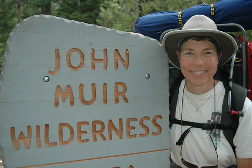
Resupplied we enter our beloved John Muir Wilderness
Beautiful blue and violet monkey flowers filled cracks in the granite outcroppings.
Bouquets of wild flowers greeted us along the trail in Bear Creek Valley.
Day 13, July 31
Crossing the swift Bear River is not as difficult as we have heard. Guide to the John Muir Trail, www.wildernesspress.com, warns of the most dangerous crossings, and we try to do those in the morning when water levels are lower because of less nighttime snow melt. We make it over Seldon Pass to stop at a dirty packer’s camp on Singer Creek. AlpineAire risotto with asparagus and shrimp is excellent. With horses to carry garbage out, we wonder why packer camps need to be littered with trash.
DAY 13: July 31, 2006 After a final look around our camp near Hilgard Creek, we headed towards Seldon Pass.
AlpineAire mushroom asparagus risotto was one of our favorites dinner entrées. www.tyry.com
Crossing inviting creeks like this one, we wished we had more time to unpack our Fenwick fly rods and do a little fishing www.fenwickfishing.com

A classic Sierra sky reflects in an unnamed tarn near Seldon Pass.
Day 14, Aug. 1
Frost everywhere. Glad we have warm sleeping bags. We wait for the sun to hit the tent. Steep switchbacks lead down into the valley and Muir Trail Ranch where our third food drop is waiting. From here we send email to friends and family letting everyone know we are OK. Returning to the JMT, we camp next to the angry San Joaquin River. A woman had slipped and presumably drowned yesterday, and rangers are still searching. The solitude of the mountains is broken by helicopters roaring overhead.
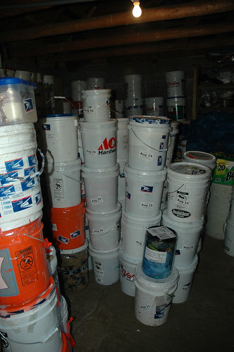
The bear proof storage shed at John Muir Ranch held our 5 gallon bucket full of resupply food and other necessities. Internet connections are available here. www.muirtrailranch.com
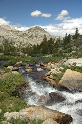
The roaring San Joaquin river carves through a canyon below the trail.
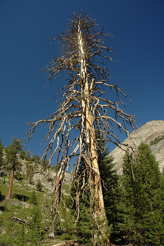
This magnificent skeleton of an ancient Ponderosa pine towered above the trail. What stories it could tell!
Day 15, Aug. 2
Hiking along the turbulent San Joaquin, we are glad to find a few bridges. Another climb brings us to the incredibly beautiful hanging Evolution Valley. Our camp above Sapphire Lake is spectacular. It feels like we are on some other planet. A huge rock outcrop looks like a spaceship landing. We can’t resist standing on the tip.
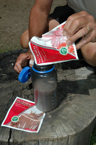
Delicious and healthy, our USANA Nutrimeal drinks gave us the extra energy we needed for a hard day’s hike. (contact us if you are interested)
Hiking up Evolution Valley early season snow melt created beautiful waterfalls.
The crossing of Evolution Creek was deep. Our MSR trekking poles gave us stability. www.msrgear.com
Water is extremely important. While we did fill our MSR hydration bags from the occasional spring, most water must be filtered. An MSR WaterWorks EX Microfilter, www.cascadedesigns.com, allowed us to pump several liters a day. The pump head screwed on to our MSR hydration bags and to our Nalgene 1-liter bottles, www.nalgenunc.com, making it very convenient to use. We saw other types of filters on the trail, but some left a chlorine taste, and other systems were slow. There was abundant water on the trail, but Guardia and other bacterial contamination can be a problem, and while hiking the JMT, you really don’t want a case of the runs.
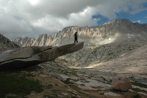
At 11,000 ft. above Sapphire Lake, this slab of granite begged to be walked on.
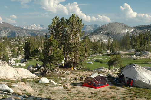
Our rocky shelf camp above stunning Sapphire Lake at 11,000 ft. was one of our favorites.
Day 16, Aug. 3
Muir Pass, 11,955 ft., is easy, even with a long stretch of snow to cross. We make a cup of coffee to celebrate and sit on the steps of Muir Hut before descending to Big Pete Meadow at 9,600 ft. to camp where fellow hikers join us for the night.
From our perch above Sapphire Lake our view was framed by the rugged peaks of the Goddard Divide.
Our approach to Wanda Lake and the snow covered peaks behind gave us an idea of what lay ahead to the Muir Pass.
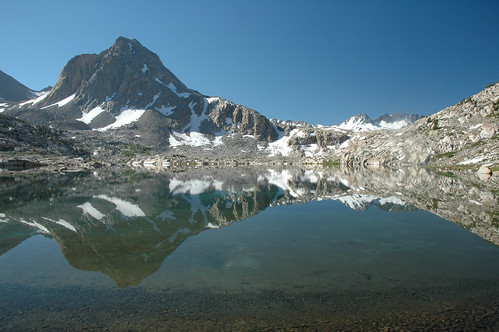
Mt. Huxley reflects into the clear waters of Sapphire Lake. The beauty was simply breathtaking.
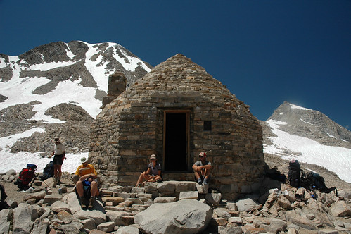
Hikers gather at Muir Hut at the top of Muir Pass, 11,955 ft.
Coming off Muir Pass, we paused to admire the amazing landscape and Helen Lake below.
We pose for a mug shot atop Muir Pass. We enjoyed a well deserved cup of coffee while watching marmots to try and get into people’s packs.
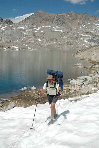
Crossing snow fields below Muir Pass we snapped on the full size baskets on our MSR trekking poles. www.msrgear.com
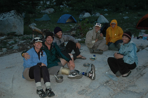
Our impromtu hiking partners share an evening in Big Pete Meadow. Notice Ed’s prothesis. We joked, hey, no blisters!
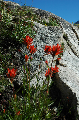
Even at this high altitude, 11,000 ft., the beautiful Indian Paintbrushes found their crevice in the boulders.
Day 17, Aug. 4
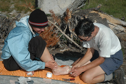
Blisters were a problem for everyone. Monika does some doctoring on Beth’s foot. Happy Birthday, Beth!!
The weather is back to beautiful, — normal. We trek through Le Conte Valley along the Kings River. Huge erratic boulders as big a bus have been deposited by glaciers. Turning up to Mather Pass, we are disgusted by the condition of the trail. A fire had burnt through the area a year or two before, and there are downed trees everywhere. We must go off the trail to find a safe way around the dead fall frequently, picking our way through boulders and climbing over blackened logs. There has been zero trail maintenance here since the fire.
We climb up the “Golden Staircase”, long and steep, carved out of the cliffs of the Palisade Creek gorge. What a job of engineering! Our camp on a ledge overlooking Lower Palisade Lake is ideal. Two couples join us, and we are treated to AlpineAire Mountain Blackberry Cheesecake for dessert, and a swig of Jack Daniels, celebrating Beth’s birthday.
Fields of wild flowers filled meadows along the trail.
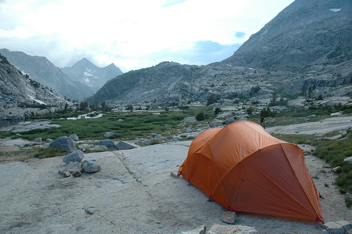
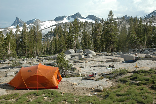
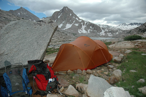
Perched on our glaciar polished patio on a ledge overlooking Lower Palisade Lake, 10,613 ft., this was the essence of backcountry camping. Our MSR Mutha Hubba was self-standing.
Despite the horrible condition going up Palisade Valley with downed trees every hundred yards from an old forest fire, our favorite Indian Paintbrush still brought color to the trail.
Day 18, Aug. 5
Crossing before and after each pass, MSR trekking poles became almost mandatory in the unstable conditions. Suction tubes from our MSR hydromedary hydration system were conveniently clipped to our pack straps.
We tackle Mather Pass, 12,100 feet. It’s pretty easy, so we sneak up a little on Pinchot Pass. We are getting used to these climbs. Several deer walk through our camp at 10,986 feet on South Bench. We wash our socks and they freeze overnight.
Descending Mather Pass, 12,100 ft., the trail skirted several beautiful unnamed ponds.
Long straight trails across the basin below Mather Pass gave us some easy hiking.
A good tent is almost mandatory. Even though weight is a consideration, our MSR Mutha Hubba three-man, www.cascadedesigns.com, was an excellent choice. Afternoon thundershowers are not uncommon in the mountains, and we wanted to put all our gear inside, except for the bear canisters. The Mutha Hubba and its smaller two-man version the Hubba Hubba, use clips on the support poles, and it takes only a minute or two to set up. We were willing to carry a couple extra pounds to have a tent big enough for our two sleeping bags and both our packs. There seems to always be something you need in your pack after you’ve crawled into your sleeping bag. It’s nice to have your gear dry and in arms’ reach after an all-night rain, and a pack leaning against a tree seems like an invitation to a bear or marmot for a free meal. For all those reasons, we loved the Mutha Hubba.
Day 19, Aug. 6
Topping over Pinchot Pass, 12,130 feet, we drop down long switchbacks to cross the bouncy suspension bridge over Wood Creek, (8,547 feet), dubbed “the Golden Gate of the Sierras”. Beautiful waterfalls along the way, and we enjoy our first campfire with fellow trekkers.
Bypassing an unnamed lake, we camped with trail friends in a beautiful meadow about a mile before Lake Marjorie.
Day 20, Aug. 7
Long climb up to camp at Rae Lakes where we see a Ranger who politely checks our permit and our bear canisters. Snow is melting fast, making creeks and rivers more treacherous to cross. Our MSR trekking poles have become essential. We see lots of fish in the 8 to10-inch range.
Day 21, Aug. 8
Glen Pass, 11,978-feet, is a long dusty trudge, but the views northward are inspiring. Descending to Charlotte Lake, we find our fourth and last food stash safely deposited in a bear box by Pine Creek Pack Train, www.bishopvisitor.com/activities/exp_pack_trips.php3, saving us the two-day climb out over Kearsarge Pass.
Snow and freezing temperatures are possible anytime of the year. Many of our camps were above 10,000 feet. Lightweight Coleman CloudCroft down sleeping bags, www.coleman.com, rated to 20°, on top of full-length Therm-A-Rest pads, www.cascadedesigns.com, gave us a warm and comfortable night’s sleep after a strenuous day. Getting a good night’s sleep and waking up fully rested is very important.
Day 22, Aug. 9
We get a late start, knowing we aren’t going to make it all the way to Forester Pass. We find a cute camp next to a creek about halfway up. Feels like sleeping in a little swallow’s nest.
Day 23, Aug. 10
Starting early, we cross several long precarious snowfields before finally reaching a windy Forester Pass, (13,120 feet). Sapphire-blue lakes and clumps of lupines decorate this barren moonscape. We camp at Frog Ponds where we take a swim. Friends who did not have a food drop at Charlotte Lake must push on ahead of us.
Day 24, Aug. 11
We’re pacing ourselves now. No hurry. An easy 4.2 miles gets us to Wallace Creek where we meet a father and son headed north. Jeremy, only 9-years old, had already summited Mt. Whitney twice!
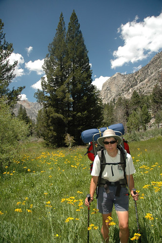
When you add clothes, first aid kit, repair kit, cookware, camera, fishing gear, warm clothes, and a long list of incidentals, suddenly the “go light” crowd starts to look inviting. We were old fashioned in some ways, willing to carry a few extra pounds for a little extra comfort, and we weren’t in a race. External frame packs are still the best design for a heavy load, and, Kelty, www.kelty.com, pretty much invented the modern external frame pack. Their Trail Series Tiogas were a practical choice.
Despite several months of conditioning before we left, it took time to acclimate to hiking mostly over 10,000 feet, with passes over eleven, twelve, and even thirteen thousand feet. Excellent trail shoes or boots are a must, and a pair of quality trekking poles became equally important, almost mandatory in some situations. Crossing the occasional snowfield, the removable full-size baskets on our MSR Overland Carbon poles, www.cascadedesigns.com, gave us much needed stability. We had originally each carried a pair of Yaktrax Pros for the expected hard packed snow and ice, but reports of softer conditions indicated they were not needed, www.yaktrax.com. Balancing on slippery rocks and logs crossing swollen streams where the book advised, “—a slip here could be fatal”, the trekking poles became our best friends. Climbing up and down 12-inch steps, they can really save your knees no matter what your age.
Day 25, Aug. 12
It’s another short day to Crabtree where we talk with the Ranger. There is some discussion of limiting commercial and military flights over Wilderness Areas. They can be very intrusive in the middle of the night. At Timberline Lake we get our first view of Mt. Whitney in the distance.
Day 26, Aug. 13
Guitar Lake is crowded so we continue up to find a sheltered camp in the boulders beyond the Arctic Lake outlet. We are alone in this wilderness of stone, and the silence is eerie, and wonderful!
Day 27, Aug. 14
Mt. Whitney looms above us. Reaching the trail junction, we drop most of our gear except for emergency clothing and food, and start the final climb. Hiking the John Muir Trail is the goal. Summiting Mt. Whitney, at 14,491 feet, is a small part of the challenge. We sign the log, take photos, enjoy the birds’ eye view, eat lunch, (with a good cup of coffee of course), and head back down, marveling at the beautiful Sky Pilot flowers bursting out of cracks in the boulders.
Trail Crest pass, at 13,620, is anticlimactic, even though it’s the highest on the route. Our final night’s stop at Trail Camp, 12,000 feet, is majestic, with Mt. Whitney in the background. There is a ¼ inch of ice on the water bucket in the morning.
It’s important to know where you are on the JMT, and signs can be missing. We found the Tom Harrison John Muir Trail Map-Pack, www.tomharrisonmaps.com, to be excellent. Comprised of 13 individual waterproof sheets, the Map-Pak covers the entire route in detail. In combination with the “Bible”, Guide to the John Muir Trail by Thomas Winnett and Kathy Morey, www.wildernesspress.com, and our Lowrance hand held i-Finder Expedition c GPS, www.lowrance.com, we were never lost. The Lowrance GPS may have saved us a half a day when we discovered our mistake above Waugh Lake. It also gave us weather predictions based on barometric pressure changes, distance traveled, average speed, altitude, and a color topo map of the entire trail showing amazing detail.
Day 28, Aug. 15
Endless switchbacks drop us from 12,000 feet to Whitney Portal at 8,361. After a hot shower, a double cheese burger with fries is an appropriate final meal. Our prearranged ride home will arrive tomorrow morning. Too soon we think.
The John Muir Trail is not a walk in the park. It does take careful planning, including a little conditioning. Many people have time to hike only a small section, and that’s great.
Proper equipment is certainly a way to make any hike more enjoyable. Start with good boots and trekking poles, and then decide about the compromises between weight, comfort, and luxury. The availability of super lightweight gear and warm clothing can drastically reduce your load. Our packs were around 50-55 pounds after a food drop. For a complete list of the equipment suppliers we used, see the list below. They represent many years of experience, and many hours of research.
What would we change? Unbeknownst to us, our excellent suntan lotion did not contain any moisturizer. Our faces were never burnt but our skin looked like old grandma’s by the time we reached Mt. Whitney. We would further research lightweight warm clothing. We’d bring four 1-gigabyte memory cards instead of two. We’d make our start date two weeks later for fewer mosquitoes and less snow on the passes, and we’d plan for 30 days and stop for some fishing at the best camps.
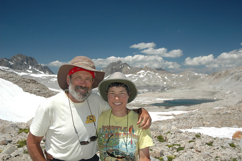
Final impression? It was really amazing and wonderful how immediate bonds and friendships were formed with fellow trekkers. Everyone had a different reason for hiking the John Muir Trail, but we all had the same goal! You will never see comparable scenery anywhere in the world, but there is a price to pay. Turns out, the price is the reward! The real bonus is that it may be the healthiest thing you will ever do in your life.